Mass Incarceration Graphic from the ACLU

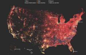
Link to data visualization from the American Civil Liberties Union (ACLU): https://www.aclu.org/infographic-combating-mass-incarceration-facts

I picked the linked data visualization about mass incarceration in the United States for a few reasons: first, the topic itself is of interest to me. Secondly, this is an example of a non-profit organization trying to call the attention of the general public to facts that are uncomfortable and at times unbelievable, which presents an interesting challenge to grab their attention and then deliver a message that motivates them to act on the information provided.

Looking at the infographic, there are a few choices the author made that make it difficult to fully understand the information delivered, as well as things s/he got right. I’ll pick two as examples:

  • Mistake: color and icon choices in the first quarter of the infographic. The author of the piece chose to use a row of 10 stars to represent the total global population and then again 10 stars to represent the total global prison population. Given that this is an infographic about the United States (signaled by the red, white, and blue colors throughout and the stars and stripes motif), I expected the denominator of each statistic shared to be the total selected U.S. population, and it was not, requiring more reading. Furthermore, the decision to represent the United States’ share of the global population in gray in the first row of stars was confusing (I typically think of gray coloring in a graphic as empty, rather than filled in…especially on a gray background). This is particularly true when in the next row of stars immediately following, the United States’ share of the global prison population is shown in red.

    Suggested fix: Use other icons (perhaps people? Globes?) to represent the total global populations of interest, and use consistent coloring when highlighting the same country of interest (in this case, the United States).

  • Well-done: The points made with the prison building graphic and the barbed wire fence spending graphic are clear and digestible. It was clear to me by looking at the illustrated prison building and reading the legend beneath it that roughly half of all prisoners are incarcerated for non-violent offenses (shown in blue) and half are jailed for violent offenses (shown in red). Looking just below, the author of the piece also did a good job showing that spending over time for corrections has grown much faster relative to spending on higher education.

    Suggested improvement: I think the point about spending would have been made more real if there were numbers attached to the values of each bar in the bar chart. Though it is clear to see that the red bars (corrections spending) are higher than the blue bars (higher education spending), as a reader I’m left wondering how that gap has widened over time, and just how much we’re spending on incarceration in this country.

Looking at the infographic holistically, I fear that the main point (or points) are buried in a sea of information that is difficult to read through and digest quickly. Given that the audience for this infographic is the general public, the ACLU should revise this piece with the intent of making a few salient, related points using clear graphics that capture the challenge or teaching point they are trying to convey.

Aerosols Billowing in the Wind

https://i2.wp.com/flowingdata.com/wp-content/uploads/2018/08/atmosphere_geo5_2018235_lrg.jpg?w=2180&ssl=1


This flowing data blog post creates an aesthetically pleasing visualization of estimates of aerosol particulates in the atmosphere on August 23rd, 2018.  This visualization uses mathematically modeled data created by NASA, and overlays the aerosol modeled data with nigh-light data collected by the Visible Infrared Imaging Radiometer Suite (VIIRS).


The audience is likely intended to be uneducated public, as opposed to NASA scientists that created the data, because the visualization is more artistic than quantitative.  It would be very difficult to pull and hard numbers or takeaways from the visualization.


The goal of this presentation is likely to raise awareness of the scope of the fires that were going on at the time in both Southern Africa and the US’s West Coast.  However, this goal is ineffectively met as there is no clear labels for the images, and it is only after reading a heavy descriptive paragraph that the audience realize this information.  I also believe too many artistic licenses were taken, as cyclones are visualized in bright blue, contrasting the red of the fire.  This is distracting and irrelevant to the goal of the visual, albeit being very cool to look at.

The Future of American Integration

I chose to evaluate the Washington Post’s Segregation Map, from May of last year. I recently came across it while reading about housing and segregation, and I thought it was a really fascinating piece.

I think the audience is pretty broad, though the premise is that these readers care about racial segregation in the first place: the findings are compelling, but only to those who are paying attention to this issue. The goal of this particular piece seems to be pretty clear and stated in the headline: “take note, readers: It is true that America is supposed to be majority-minority in a matter of decades, but that does not mean we are integrated or getting along any better.” In today’s political climate, I think this finding is particularly compelling when we talk about what progress might actually look like.

In many ways, I think the visualization is extremely effective: it is taking quite a lot of census data about race and ZIP code representing 325 million people in a series of maps to show both population and race density. It makes a compelling argument for the fact that we have not, in fact, integrated despite a rise in diverse populations.

But at the same time, I feel it is slightly misleading: does the fact that Houston (as an example) looks more integrated on the map mean it is actually more integrated? My instinct says no, but the visualization challenges my own perspective, which ultimately makes it quite powerful.


Journalist Death Records: A Global Overview

This interactive graph by Soha Elghany portrays the death records from the  CPJ (Committee to Protect Journalists). The visualization shows the number of journalists who have died around the world, it uses blue to represent past deaths and red for recent ones. It is also possible to interact with each of the spirals and explore every data point as a story.

The visualization’s goal is to provide an overview of a global problem and let the reader explore it story by story. In my opinion, the main audiences for this work are researchers and the general public. Because the focus is put into navigating stories rather than stats and predictions.

The visualization does a good job getting its core message through as in “journalists are being oppressed worldwide”.  Also, having the data points represented as spirals helps to understand the scale of the problem. However, each data point in the spiral is not the same, while for some countries a data point represents 2 deaths for others it can represent dozens. Also, there is no consistent datapoint sizing, in some cases, 49 deaths can be 4 data points whereas in others they are represented by 2 or 3 data points. From a reader perspective, the choice of font type and size is not ideal, it makes the visualization harder to read. In addition, the choice of colors does not enhance the reading experience. Regional filtering/grouping would have been very insightful to have in this viz.

Link to the data viz

Data Visualization is an Art

Anyone who enters the visitor center at NASA’s Jet Propulsion Lab gets a few fun treats to take pictures with – a cardboard model of Curiosity, a collection of mission patches; but one of the most eye-catching, and in my opinion, interesting, installations is this large sculpture with flickering lights. After your first glance, you begin to notice the pattern – the outside strands have lights that moves up or down, and the inside cylinder has text that appears on it. This stunning mixture of art and data visualization, JPL’s light sculpture is designed to help non-technical visitors learn just how connected we are with space. Using live data, the sculpture cycles between different US satellites, displaying the name of the current satellite on the central piece, and illustrating the magnitude of the data being uplinked and downlinked from that satellite at the time on the outside. The more data, the more lights will turn on, with uplinks moving up the sculpture, and downlinks moving down.

While this might not communicate detailed technical data, it’s a very effective visualization tool, because it’s targeted towards non-technical guests and tourists. Often, space feels “far off” and removed from daily life – this sculpture intends to form a different impression with visitors to show that the work being done at NASA matters, and that Earth is actually communicating with satellites in space all the time. Although there is an informational stand next to the sculpture, the eye-catching scrolling text allows you to deduce what information is being conveyed without reading the sign.

If you want to see the sculpture in action, check out a video here: